
Walks Around Addingham
One of the best ways to appreciate and learn more about the natural environment is to walk in the countryside. Addingham, like many villages in England, has an extensive network of public footpaths, many of them established in medieval times.
Here is a collection of circular walks, of varying length and difficulty, all starting in the village and going out into the delightful countryside around Addingham, from The Moorside in the south to Bolton Abbey in the north; Ilkley in the east to Counter Hill in the west. All the walks have optional shortcuts so that it’s possible to choose your option to suit your available time and energy level. Using different starting points give even more options.
The walks are described below, with links to full route details in PDF format which can be downloaded and printed off on A4 paper.
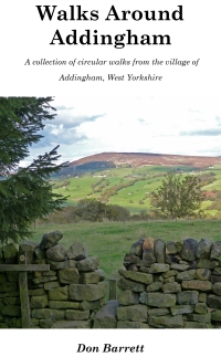 They have been published in book form: ‘Walks Around Addingham’ by Don Barrett. In addition to the route directions, the book includes much additional information on the history, natural history and geology of the buildings and landscape to be seen on the walks. See the Books page for details of the book and how to get it.
Updates
Following comments from users, I have amended some of the walks and updated details. The amended routes are shown below and will be in future revisions of the book. An insert page to update existing books is available here – 2021 update insert.
It has been suggested that the dog-friendliness of the walks would be helpful. Not being a dog owner I cannot comment but please let me have any comments about problems walking with dogs as below.
Please report errors, omissions, criticisms or even praise(!), plus suggestions for improvement, via the Webmaster Contact Form.
GPS Navigation
Those with a smartphone or tablet may find it useful to use it as an aid to navigation. We use an app called Outdooractive (outdooractive.com, apps are available for IOS and Android). The free maps included (based on the OpenStreetMap) are actually quite good and show most (though not all) footpaths, but OS maps are available with the ‘Pro’ version. Maps can be used offline if downloaded in advance.
If using your phone, ensure that it is fully charged at the start (GPS uses more power than just the phone) and, preferably, carry a power bank to recharge in the field. Also, carry a paper map and compass as backup.
These routes have been added to the Outdooractive collection – tap ‘Find a route’ and search for Addingham.
The Countryside Code
Please follow The Countryside Code – in particular, leave no litter, leave gates as you found them and keep dogs on a lead when farm animals are around. Click countryside-code for a copy.
The Walks
Combined Map – This shows all the walks in the book

Ordnance Survey maps reproduced with permission
Copyright 2017 Licence CS 29084-H6Q3K7
For more information about each of these walks please click on the appropriate link below:
Walk 1: Highfield, Lob Wood & Riverside
Walk 2: Beamsley Beacon and Bolton Abbey
Walk 3: Ilkley and back via Nesfield, Middleton & Dales Way
Walk 4: Addingham Blue Plaques Trail
Walk 5: Netherwood House, Heber’s Ghyll and the Moor Edge
Walk 6: Moorside and Millstones
Walk 7: Southfield, Marchup and High Laithe
Walk 8: Counter Hill & Round Dykes